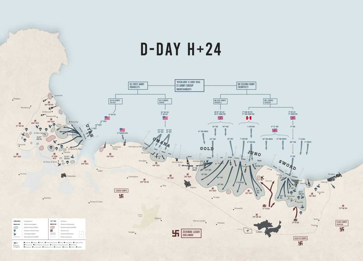
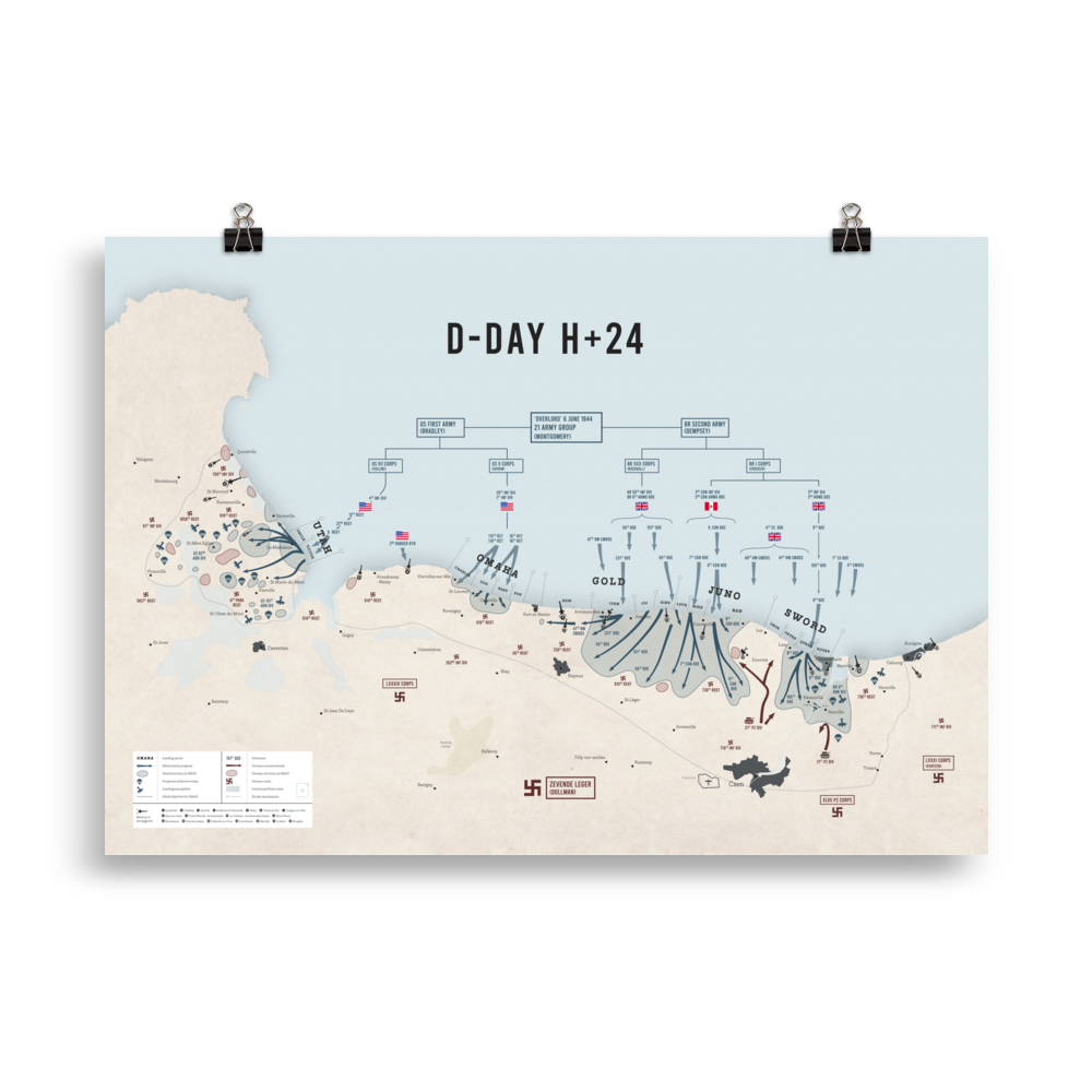
D-day beaches and amphibious landings
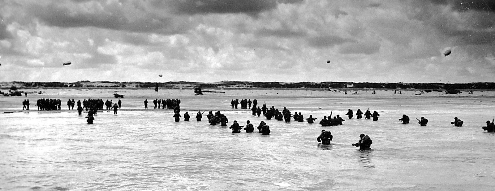
The beaches/areas where the amphibious landings took place played an important role during D-Day and were each given their own code name – Utah, Omaha, Gold, Juno and Sword. The landings took place in a zone 80 km wide and took place from 6 a.m. on June 6, 1944.
Utah Beach
Utah Beach, the westernmost beach of the five landing sites. It was attacked by units of the U.S. 4th Infantry Division and was taken with relatively few casualties. On the eve of D-Day, troops from the 82nd and 101st Airborne Divisions were dropped behind this landing zone.

Located on the eastern side of the Cotentin Peninsula, Utah Beach was a late addition to the D-Day beaches planned for the invasion. The original plan for Operation Overlord did not call for a landing on the Cotentin, but General Dwight D. Eisenhower, Commander-in-Chief of the Allied Expeditionary Force, added it to ensure an early capture of Cherbourg Harbour at the northern tip of the peninsula.
The landing plan went wrong from the start. Strong currents drove the landing craft away from their objective and the area was obscured by smoke from the preceding coastal bombardment. But the biggest problem was the loss of three of the four designated control craft to mines. The troops landed 1,800 metres east of the designated landing area, in the less secure sector of Victor.
- H-hour: 6h30
- Width: 5km
- Allied units: US 4th Infantry Division
- Allied Troops Deployed: 20,000
- Allied Casualties: 300
- German units: 709th, 243rd and 91st
- Sectors: Tare Green, Uncle Red, and Victor


Pointe du Hoc
Pointe du Hoc, an ominous stretch of land jutting into the English Channel, provided an elevated vantage point from which enormous German guns with a range of 25 km could fire at both Omaha Beach (7 km, to the east) and Utah Beach (11 km, to the west). Allied intelligence had identified five 155-mm guns in reinforced concrete casemates at Pointe du Hoc and Allied commanders had determined that the neutralisation of these guns was crucial to the fate of the Omaha and Utah landings. The area was defended by elements of the German 352nd Infantry Division.
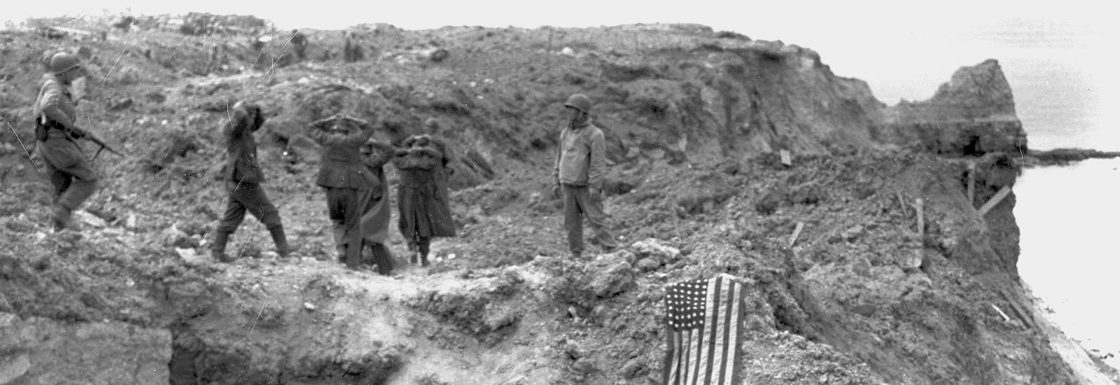
Company D, E and F landed at the Pointe at 0710 hours, 40 minutes later than their planned landing time. They had to cope with a heavy sea and gusts of wind, which sank one of their landing craft. Once landed, however, the Rangers, while climbing, ended up in a firefight with the German soldiers present. Within minutes the first Ranger reached the top. In small groups they fought their way to the casemates, only to find that the guns had disappeared. They moved forward and cut the road behind the area, discovering the guns about 500 metres from the casemates. The guns were pointed at Utah Beach. Using thermite grenades, the two Rangers melted down the guns’ lifting and transit mechanisms, disabling them. Then they returned to their positions.
They were thus the first American unit to complete their mission on D-Day, at the cost of half their force. Towards the end of the day they defended a small area on the higher part of Pointe du Hoc while the Germans made several counter attacks. The Rangers held out for two days until help arrived.


Omaha Beach
Omaha Beach was the second beach from the west among the five D-day beaches of the Normandy Invasion. It was attacked by units of the US 29th and 1st Infantry Divisions. Many soldiers drowned while approaching the beach or were killed by defensive fire from German troops positioned on high ground around the beach.
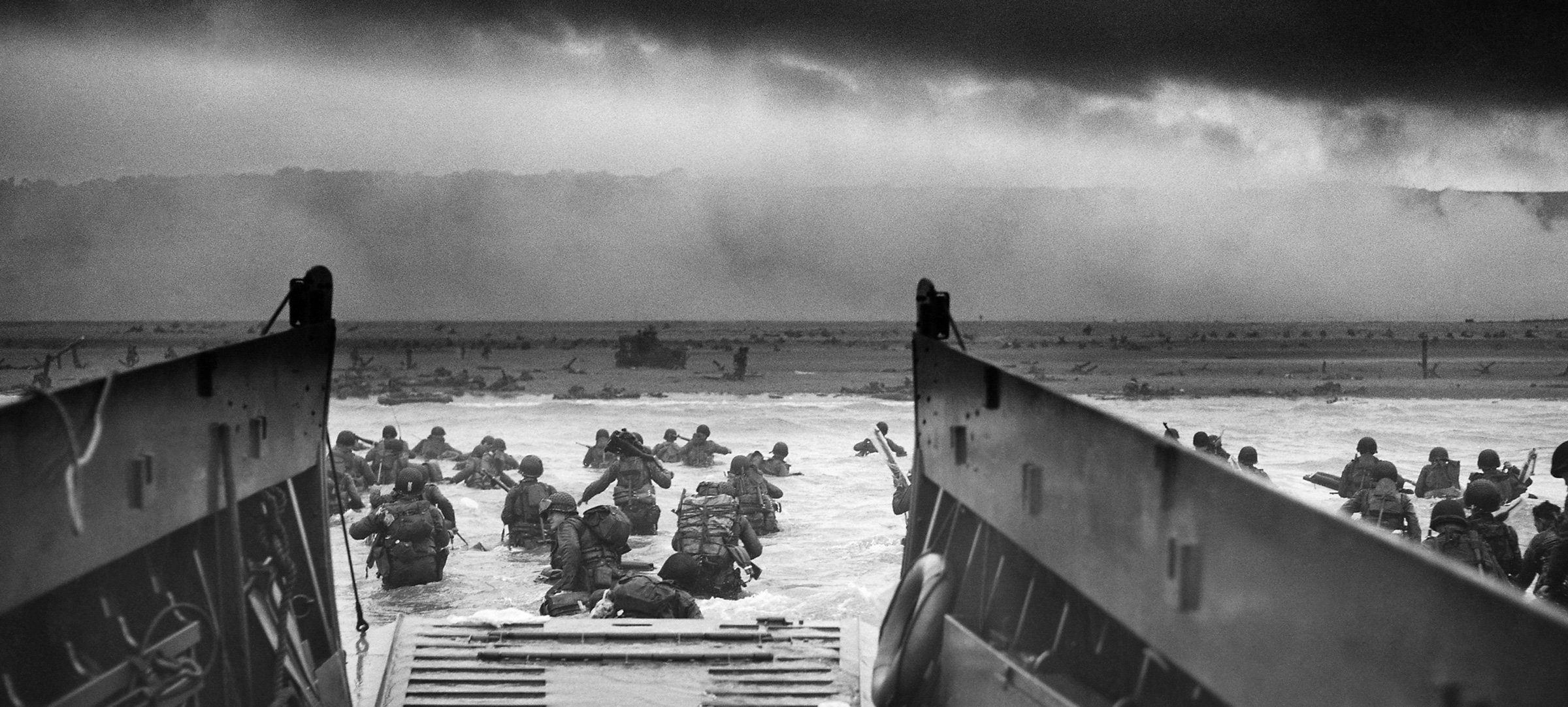
The largest of the D-Day beaches, Omaha Beach stretches over 10 km between the fishing port of Port-en-Bessin in the east and the mouth of the River Vire in the west. The western part of the beach consists of cliffs 30 metres high. There were five exits in this landing zone; the best was a paved road in a ravine leading to the holiday village of Vierville-sur-Mer, two were just dirt tracks, and two were dirt tracks leading to the villages of Colleville-sur-Mer and Saint-Laurent-sur-Mer.
The Germans, under Field Marshal Erwin Rommel, had built a formidable defence to protect this enclosed battlefield. The water and the beach were heavily mined and there were 13 strong points called Widerstandsnester (“resistance nests”). Numerous other fighting positions were dug out, supported by an extensive trench system. The defence forces consisted of three battalions of the 352nd Infantry Division. Their machine guns were positioned to cover the beach with a crossfire. Omaha was a killing zone.
- H-hour: 6.30 am
- Width: 10km
- Allied units: US 1st & 29th Infantry Division
- Allied troops deployed: 34.000
- Allied Casualties: 2400
- German units: 352nd Division
- Sectors: Charlie, Dog, Easy & Fox


Gold Beach
Gold Beach was the most central of the five designated landing sites of the Normandy Invasion. It was taken on June 6 by units of the British 50th Infantry Division.
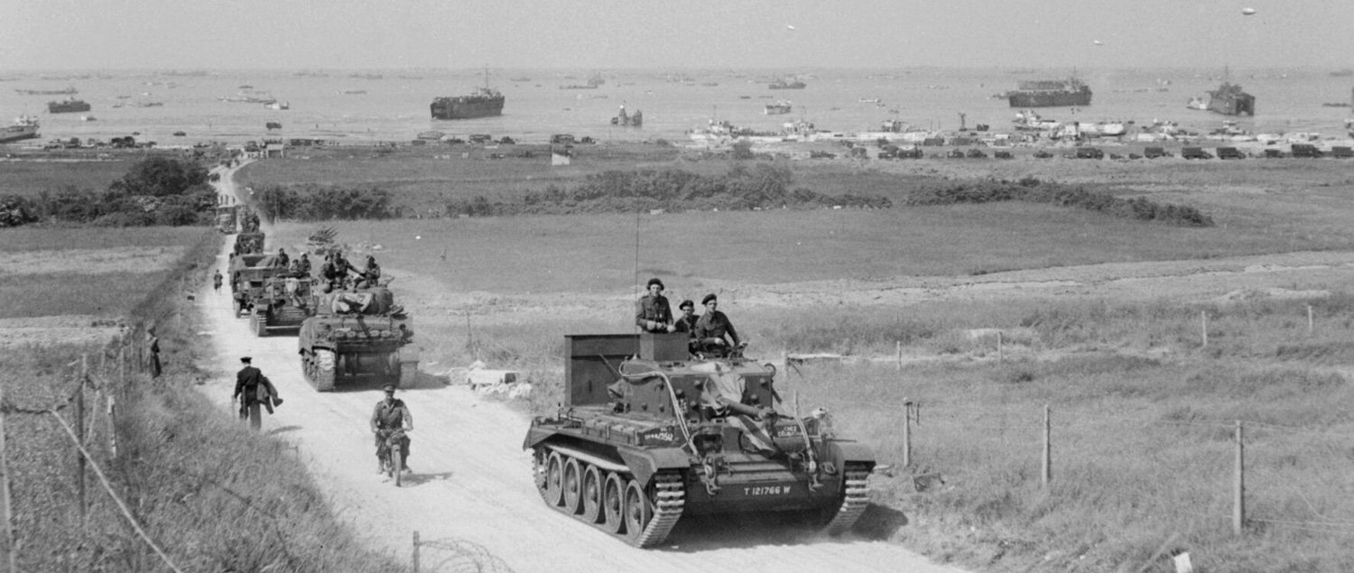
The landing area, codenamed Gold Beach, was more than 8 km wide and included the coastal towns of La Rivière and Le Hamel. To the west of the beach was the small port of Arromanches, and just west of that port was the town of Longues-sur-Mer.
The objectives of the 50th Division were to cut off the Caen-Bayeux highway, take the small port of Arromanches, link up with the Americans from Omaha Beach to the west at Port-en-Bessin, and link up with the Canadians from Juno Beach to the east. The 50th Division also had to take the Longues Battery.
The defending German forces consisted of elements of the 716th Division and at least part of the 1st Battalion of the experienced 352nd Division at Le Hamel. Many of the Germans were based in houses along the coast, with the largest concentrations at Le Hamel and La Rivière.
- H-hour: 7h25
- Width: 8km
- Allied units: 50th Infantry Division
- Allied Forces deployed: 25,000
- Allied Casualties: 400
- German units: 716th Division and parts of the 352nd Division
- Sectors: How, Item, Jig & King


Juno Beach
Juno Beach, the second beach from the east of the five D-Day beaches. It was attacked by units of the Canadian 3rd Infantry Division, who suffered heavy losses in the first wave, but managed to take control of the area by the end of the day.
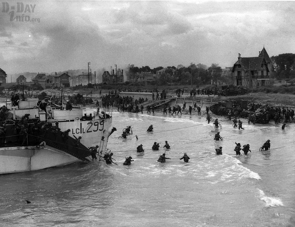
The landing site codenamed Juno Beach was about 10 km wide and stretched out on either side of the small fishing port of Courseulles-sur-Mer. Two smaller villages, Bernières and Saint-Aubin, lay to the east of Courseulles. Smaller coastal villages lay behind the dunes and had been fortified by the occupying forces with casemates and adjacent fighting posts.
The objectives of the 3rd Division on D-Day were to cut off the road between Caen and Bayeux, seize Carpiquet aerodrome west of Caen and form a link between the two British beaches of Gold and Sword on either side of Juno Beach.
However, the initial danger to the Canadians at Juno was not the German obstacles, but natural sea obstacles such as sandbanks and reefs. These forced the waves of attack to land later than desired: H-Hour (the time when the first wave of attack would hit the beach) was set for 0745 hours. Elements of the German 716th Infantry Division, notably the 736th Regiment, were responsible for defending the area. The houses on the embankment provided them with excellent observation and firing positions.
- H-hour: 7h45
- Width: 10km
- Allied units: Canadian 3rd Infantry Division
- Allied men deployed: 21,400
- Allied Casualties: 1200
- German units: 716th Division
- Sectors: Love, Mike & Nan


Sword Beach
Sword Beach was the easternmost of the five D-day beaches. It was attacked by units of the British 3rd Division, with French and British commandos in attendance. Shortly after midnight on D-Day, elements of the 6th Airborne Division, in a daring glider attack, seized bridges inland and also silenced the artillery pieces that were threatening the landing troops overseas.
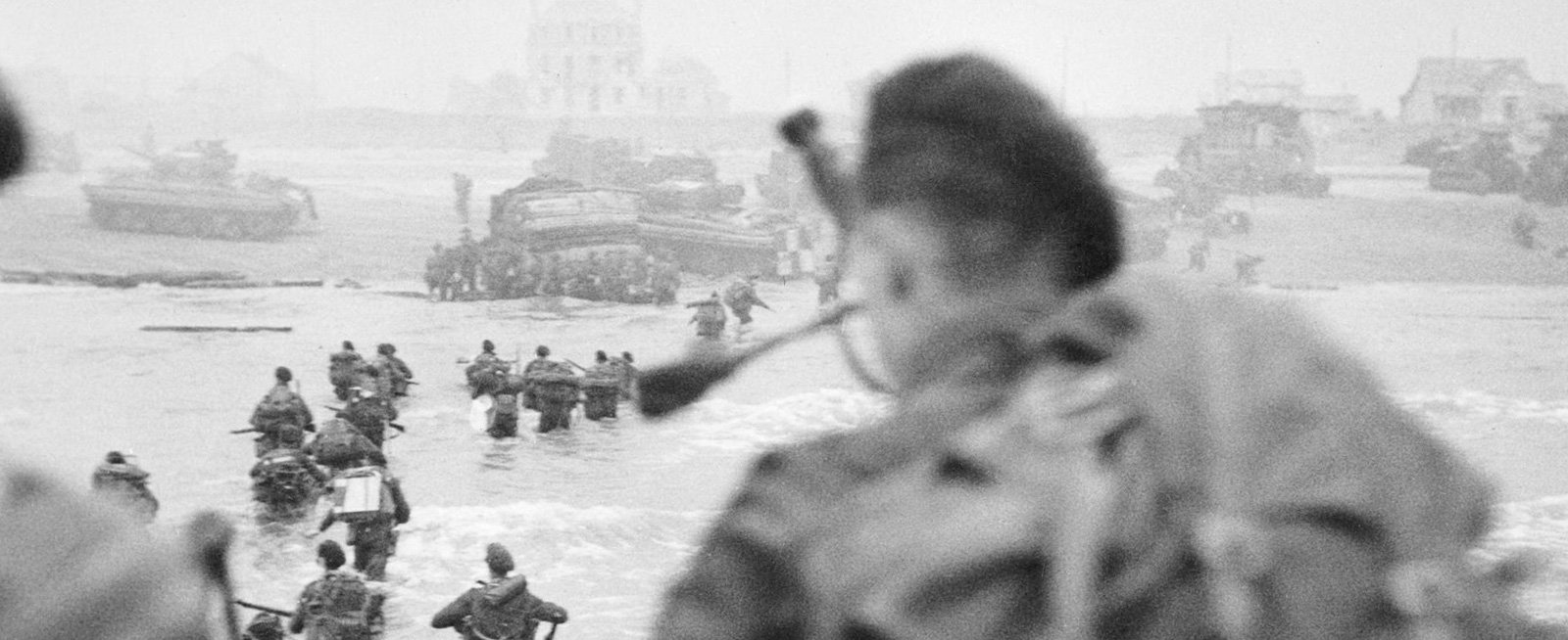
The area code-named Sword Beach stretched 8 km from Lion-sur-Mer in the west to the town of Ouistreham, at the mouth of the River Orne, in the east. The area was rich in holiday homes and tourist facilities located behind the sea wall. It was also about 15 km north of the city of Caen. All major roads in this sector of the Normandy countryside passed through Caen, and it was an important city for both Allied and German transport and manoeuvres.
The Germans had fortified the area with relatively light defences consisting of beach barriers and fortified positions in the dunes. However, the bulk of the beach defence was the battery at Merville some 8 km east across the estuary of the River Orne and 155-mm guns some 32 km further east at Le Havre.
The objective of the 3rd Division was to take Sword Beach and, via Ouistreham, to capture Caen and the important airfield of Carpiquet nearby.
- H-hour: 7h25
- Width: 8km
- Allied units: British 3rd Division
- Allied Forces deployed: 29,000
- Allied Casualties: 630
- German units: 716th Division & 21st Armoured Division
- Sectors: Oboe, Peter, Queen, & Roger



Have you noticed a language or writing error? Please let us know, as this will only improve our reporting. We will correct them as soon as possible. Your personal data will be treated confidentially.
Report error